Appledore Shipyard, North Devon
Water Services
Flood Risk Consultants
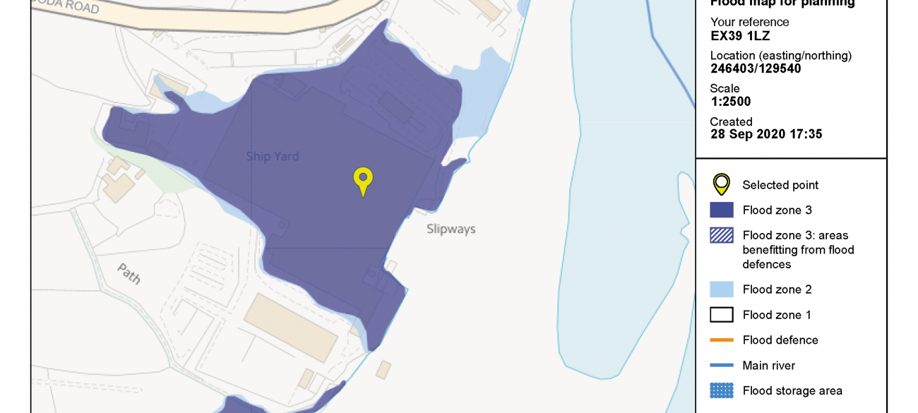
Appledore Shipyard was considered to be of High Sensitivity from flood risk sources and therefore a Flood Risk Appraisal was subsequently commissioned to assess the flood risk from all sources (tidal, fluvial, surface water, groundwater and artificial sources) along with suitable mitigation measures to provide an informative report on the potential flood risk/liability to support the investment purchase of the Shipyard.
Purpose
The successful £7 million acquisition of the historic Shipyard will provide a huge economic boost for the area, providing employment for between 100-200 skilled workers and welcomed Prime Minister Boris Johnson to the Site following the deal.
Scope of Works
▲ Assess flood risk from all sources using best available information including review of EA data and mapping, topography and historical records;
▲ Assess previous relevant studies, local authority plans or strategies;
▲ Advise on flood mitigation measures and residual risks;
▲ Assess evacuation routes;
▲ Advise on availability of flood warnings; and prepare a Flood Risk Appraisal report.
Outcomes / Client Benefit
Utilising our in-house Water Services team, we delivered the following benefits and outcomes:
▲ By demonstrating that the Site is not in a Flood Warning Area, has no recorded history of flooding and by the ‘water compatible’ nature of Appledore Shipyard, the Site was considered to be at Low and Acceptable risk of fluvial flooding.
▲ Demonstrated safe access and egress via Wooda Road during both fluvial and surface water events with a precautionary recommendation to complete a Flood Response Plan to allow for business continuity and safe emergency and evacuation due to the Sites proximity to Knapp Stream.
▲ The main surface water flow path was shown to occur during the low probability event (0.1% to 1% annual probability) with depths largely less than 300mm which is considered passable by vehicles and people. Where direct ponding was occurring in the medium to high risk scenarios and depths >300mm these were highlighted as places to avoid during a storm event. Recommendations included maintaining the on-site drainage so as not to exacerbate surface water risk.
▲ Demonstrated that the Site is not located within an area considered to be of a significantly elevated risk of flooding
Filter
Contacts
-

Alex Perryman
Associate Director, Water Services
.(JavaScript must be enabled to view this email address)
